What is Highway Alignment?
Highway alignment refers to the horizontal and vertical positioning of a road on a plan. Selecting the right alignment is one of the most critical decisions in highway engineering — a poor choice, once construction begins, is extremely expensive or impossible to correct.

1. Obligatory Points
Obligatory points are specific locations the alignment must either pass through or avoid. They are identified during the map study and reconnaissance stages and form the backbone of alignment selection.
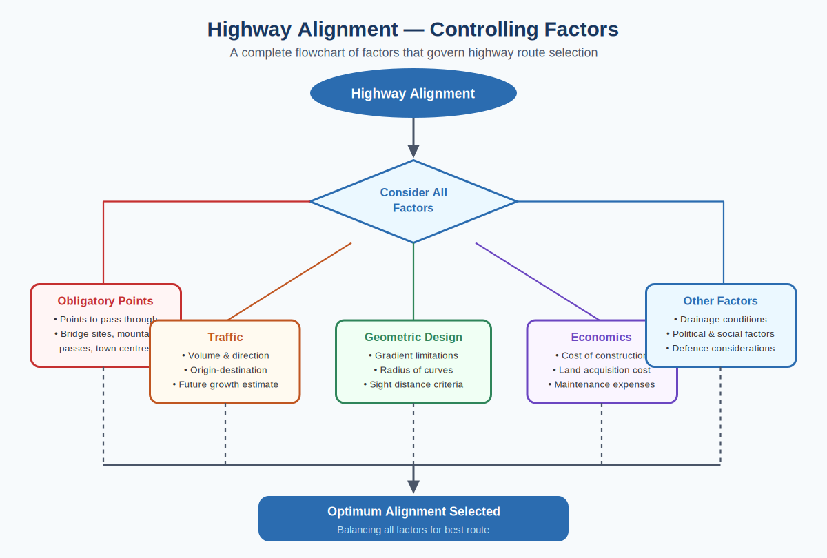
- Must pass through: Bridge sites on rivers, mountain passes, railway crossings, town centres that must be connected
- Must avoid: Lakes, swamps, reserved forests, high-cost land zones, unstable slopes, flood-prone areas
2. Traffic Considerations
- Origin-destination studies identify major traffic movement corridors
- Volume and vehicle composition influence the standard of alignment required
- Future traffic growth projections determine design capacity
- The alignment should avoid unnecessary detours and indirect routing
3. Geometric Design Constraints
- Maximum gradient: 5–6% on plain terrain, up to 10% on steep terrain (IRC standards)
- Minimum horizontal curve radius: Higher design speed requires a larger radius
- Sight distance: Adequate stopping and overtaking sight distances must be maintained throughout
- Superelevation: Maximum 7% on plain terrain, 10% on hilly terrain
4. Economic Factors
- Total construction cost including earthwork, structures, and drainage
- Land acquisition and resettlement cost
- Maintenance cost over the design life of the road
- User benefit: reduced travel time, fuel savings, and lower accident rates
5. Other Key Factors
- Drainage: Follow natural drainage divides to minimize culvert requirements
- Visibility: Adequate sight distances at curves and crests
- Political and social factors: Connect important areas while minimizing community displacement
- Defence: Strategic connectivity to border and military installations
- Environment: Avoid ecologically sensitive zones, wildlife corridors, and protected forests
Types of Alignment Criteria
| Criterion | Description |
|---|---|
| Shortest Route | Minimizes construction length but may face difficult terrain |
| Flattest Route | Minimizes gradient — ideal for heavy vehicle traffic |
| Best Soil Route | Avoids problematic soils like expansive clays and swamps |
| Intermediate Route | Balances all factors — the most practical real-world choice |
In India, IRC SP:19 (Manual for Survey, Investigation and Preparation of Road Projects) provides detailed guidance on the alignment selection and evaluation process.