Why Road Classification Matters
A well-structured road network requires systematic classification so that each category serves a specific purpose — from high-speed inter-city movement to last-mile village connectivity. In India, roads are classified based on function, administrative jurisdiction, and traffic characteristics as per the Indian Roads Congress (IRC) and MoRTH.
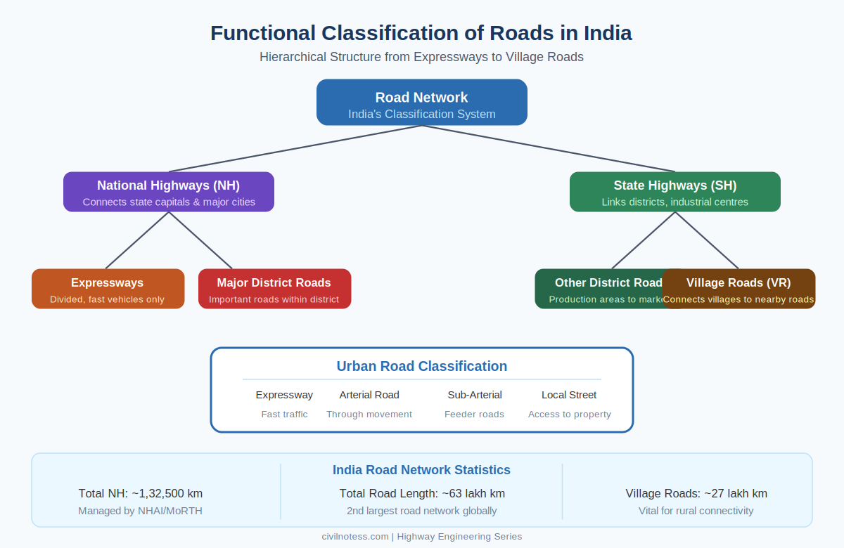
1. National Highways (NH)
National Highways form the primary arterial network of India. They connect major cities, state capitals, ports, industrial hubs, and international borders. These roads are managed by NHAI and MoRTH.
- Total NH network: approximately 1,32,500 km across India
- Designed for high-speed traffic with divided carriageways
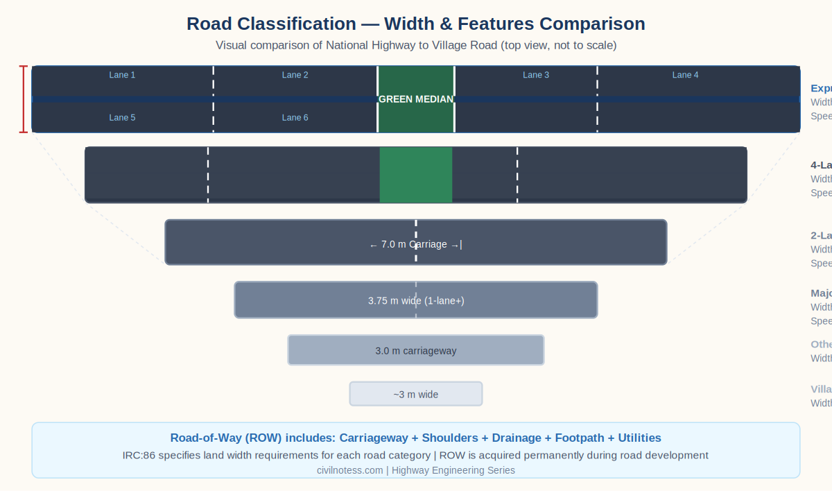
- Minimum carriageway width: 7.0 m (2-lane) to 14.0 m (4-lane)
- Right of Way (ROW): 30–60 m depending on lane configuration
- Examples: NH-44 (Srinagar to Kanyakumari), NH-48 (Delhi to Chennai)
2. Expressways
Expressways are completely access-controlled, high-capacity roads permitting only fast-moving motor vehicles. Grade-separated interchanges and median barriers are standard features.
- Entry and exit only at designated interchanges — no at-grade crossings
- Design speed: 100–120 km/h | ROW: 45–90 m
- Examples: Yamuna Expressway, Mumbai-Pune Expressway, Delhi-Meerut Expressway
3. State Highways (SH)
State Highways connect district headquarters, important towns, and industrial areas within a state. Managed by State PWD, they serve as feeder roads to National Highways.
- Design speed: 80–100 km/h | Carriageway: 7.0 m (2-lane)
- ROW: 12–24 m typically
- Connects state capitals with district headquarters and industrial zones
4. Major District Roads (MDR)
MDRs are important secondary roads within a district, connecting tehsil headquarters and smaller towns to State and National Highways. Carriageway width: 3.75 m (single lane), ROW: 9–12 m.
5. Other District Roads (ODR)
ODRs serve agricultural areas, connecting villages and mandis to higher-category roads. Maintained by district panchayats and local bodies. ROW: 7.5–9 m.
6. Village Roads (VR)
Village Roads connect habitations to each other and to higher-category roads. Under PMGSY, massive investment has ensured all-weather connectivity for rural communities. ROW: 3–5 m typically.
Urban Road Classification
| Road Type | Function | Design Speed |
|---|---|---|
| Expressway | High-speed inter-city movement | 80–100 km/h |
| Arterial Road | Main through-movement corridors | 50–80 km/h |
| Sub-Arterial Road | Feeds traffic to arterials | 40–60 km/h |
| Collector Street | Collects and distributes local traffic | 30–40 km/h |
| Local Street | Direct access to properties | 20–30 km/h |
Nagpur Plan Road Length Formulas
- NH Length = Area (sq km) ÷ 50
- SH Length = Area (sq km) ÷ 25 + 6.25 × (Towns with population above 5,000)
- MDR Length = 90 × Number of towns + 4.74 × Number of villages