Introduction to Highway Surveys
Before a single metre of road is built, engineers conduct a systematic series of surveys to gather data on topography, soil, drainage, and traffic. These surveys are the backbone of all design decisions. In India, highway surveys follow IRC SP:19 — the Manual for Survey, Investigation and Preparation of Road Projects.
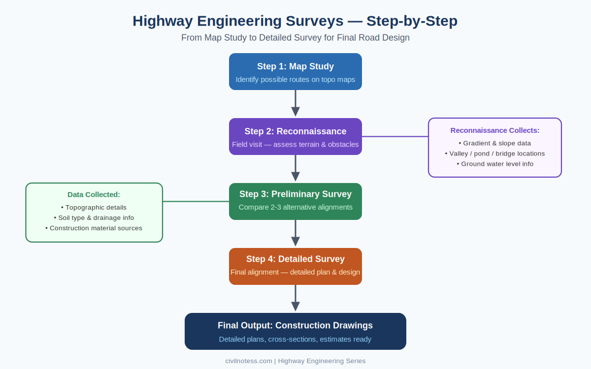
Stage 1: Map Study
The survey process begins in the office. Engineers study topographic maps, satellite imagery, and existing road maps to identify all feasible route corridors between the project’s origin and destination.
- Survey of India (SOI) topographic maps at 1:25,000 or 1:50,000 scale are primary references
- Obligatory points — both required and avoided — are marked on the map
- Typically 2–3 broad route options are identified for field evaluation
Stage 2: Reconnaissance Survey
Reconnaissance is the first field visit to the proposed corridor. The purpose is to get a general understanding of terrain and narrow down route options. No precise instruments are used — this is primarily a visual assessment.
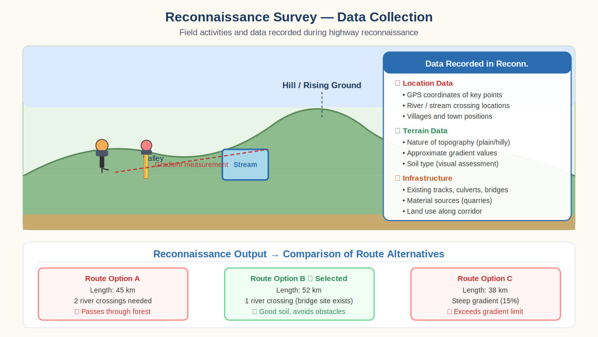
- General character of topography — plain, rolling, hilly, or steep terrain
- Location of rivers, streams, valleys, and major physical obstacles
- Soil type assessed visually along each route
- Existing infrastructure — bridges, culverts, tracks — is noted
- Approximate gradient changes and ground elevation variations recorded
Stage 3: Preliminary Survey
The preliminary survey involves detailed field investigation of the 2–3 shortlisted routes. Survey instruments are used to measure topography precisely, and comprehensive data is gathered to prepare strip maps and cost estimates.
- Topographic survey: Longitudinal sections and cross-sections at 50 m intervals
- Soil investigation: Trial pits and borings to assess subgrade strength
- Drainage survey: Catchment areas, flood levels, culvert/bridge requirements
- Traffic survey: Volume count, speed studies, origin-destination data
- Material survey: Availability and distance of aggregates, sand, and bitumen
Stage 4: Detailed Survey
Once the final alignment is approved, a detailed engineering survey produces all data needed for construction drawings and cost estimates. This is the most technically intensive phase.
- Precise centreline setting using theodolite and total station
- Detailed longitudinal profile and cross-sections at 20–30 m intervals
- Soil investigation with laboratory testing (CBR, Atterberg limits, grain size analysis)
- Hydrological analysis for all drainage structures
- Detailed land acquisition plan using cadastral survey data
- Environmental Impact Assessment (EIA) studies
Summary: Comparison of Survey Stages
| Stage | Location | Purpose | Output |
|---|---|---|---|
| Map Study | Office | Identify route corridors | 2–3 possible routes |
| Reconnaissance | Field (visual) | General terrain assessment | Route comparison report |
| Preliminary Survey | Field (instruments) | Compare 2–3 alignments | Best alignment recommended |
| Detailed Survey | Field (precise) | Final design data | Construction drawings & estimates |